
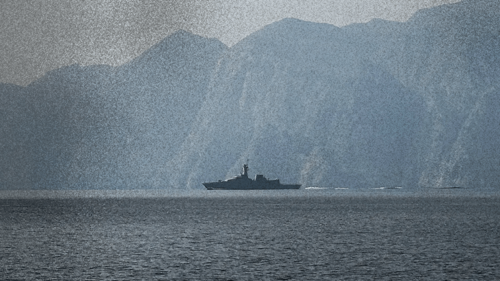
GPS interference at Hormuz exposed how U.S.-controlled navigation infrastructure becomes part of war when Iran resists attack.
More Than 1,100 Ships Lost Their Place
Within 24 hours of the opening U.S.-Israeli attack on Iran, navigation interference spread across the Persian Gulf, the Gulf of Oman and the Strait of Hormuz. The maritime intelligence company Windward reported that more than 1,100 vessels experienced disruptions affecting their satellite-derived positions and Automatic Identification System data. It identified at least 21 interference clusters across Iranian, Emirati, Qatari and Omani waters. Ships appeared electronically at airports, on land and beside a nuclear power plant while their physical hulls remained at sea.
The pattern was too large and geographically concentrated to dismiss as malfunctioning equipment aboard individual vessels. A ship can misconfigure its transponder, a receiver can fail and a crew can enter incorrect voyage information. None of those explanations accounts for hundreds of ships simultaneously broadcasting impossible positions inside distinct regional clusters. Something was interfering with the positioning layer beneath maritime traffic.
The event was immediately described as GPS jamming. That description captured the scale of the disruption but compressed several different technologies into one phrase. What the public data established was widespread interference with satellite-derived navigation and the vessel positions transmitted through AIS. It did not establish the location and operator of every transmitter. That limit does not dissolve the political argument. It defines where documented fact ends and material inference begins.
The War Had an Author
The interference did not emerge from an empty sea. On February 28, the United States and Israel launched massive military strikes against Iran. The United Nations described Iran’s attacks across the region as subsequent retaliation. The opening assault occurred after another round of indirect negotiations and while preparations were underway for further technical and political talks. The escalation transformed the Gulf into an active battlespace.
Aircraft, missiles, drones, naval forces, air-defence systems and surveillance platforms were operating across a region already filled with American bases and military infrastructure. Civilian shipping occupied the same geography. The resulting electronic interference therefore cannot be narrated as a free-floating Iranian disruption of peaceful commerce. Washington and Tel Aviv initiated the war, while Iran faced an immediate requirement to defend its territory, strategic facilities and military operations against forces deeply dependent on satellite navigation. The shipping industry inherited the consequences because commercial and military systems were already using the same signals and occupying the same space.
When the Sky Closes: What the Emirates Shutdown Means traced the same process through civil aviation. Airlines stopped because the U.S.-Israeli war had turned supposedly insulated commercial airspace into military operating territory. At Hormuz, the same contradiction appeared through false coordinates.
GPS Is an American Military System
GPS is often experienced as a neutral utility. A phone displays a map, a ship calculates its position, a bank synchronizes a transaction and an electrical grid maintains precise timing. The signal appears to arrive from nowhere and belong to everyone. The infrastructure has an owner.
The Global Positioning System is operated by the United States Space Force. Its satellite constellation is commanded through a military control network centred at Schriever Space Force Base. The Space Force describes GPS as the Department of Defense’s largest satellite constellation and acknowledges that the same military-operated system provides positioning, navigation and timing to civilian and commercial users around the world. Civilian access is broad and normally free, but that does not make the underlying system politically neutral.
The United States determines how the constellation is maintained, modernized, defended and integrated into military operations. American forces receive protected military signals and develop equipment designed to continue functioning through contested or degraded conditions. Commercial users receive an extraordinarily useful public service through infrastructure operated as a strategic national asset. The arrangement works smoothly while U.S. control remains invisible. War makes it visible.
Washington Explicitly Preserves Navigation Denial
The United States does not merely operate GPS. It openly maintains the right and capacity to deny satellite navigation to adversaries. Official U.S. policy states that hostile use of GPS may be prevented through localized military jamming. Earlier policy documents went further, directing the Department of Defense to develop capabilities capable of denying adversaries access to GPS, its augmentations and other space-based positioning, navigation and timing systems within an area of military operations. The policy recognizes navigation as an instrument of war.
A military that can locate itself, guide its weapons, synchronize its communications and coordinate its forces possesses an advantage. A military denied reliable positioning must revert to less precise and less integrated methods. The ability to provide navigation to your own forces while denying it to an opponent is therefore not an accidental feature of satellite infrastructure. It is a declared military objective. This gives the Hormuz disruption its larger meaning.
The system marketed as a universal public service exists alongside a military doctrine of selective access, protected use and localized denial. Civilian dependence has grown around infrastructure whose operator openly plans for the moment when signals become part of combat. When another state attempts to contest that advantage, Western reporting describes the result as disorder entering an otherwise neutral system. The system was never neutral.
Selective Availability Is Not the Issue
The United States once used Selective Availability to reduce the accuracy available through civilian GPS signals. That global degradation was discontinued in May 2000. It is inaccurate to claim that Washington can simply switch the old system back on across the current constellation. Official U.S. policy says Selective Availability will not return and that newer GPS satellites were designed without it.
The stronger argument is what replaced it. The United States developed regional denial capabilities intended to prevent hostile use without degrading civilian access across the entire planet. The military moved from indiscriminate global degradation toward localized navigation warfare. That correction strengthens the political analysis.
Washington does not need to make every civilian receiver in the world less accurate. It seeks the ability to determine whose navigation works inside a particular battlespace. Control becomes more targeted, not less military.
GPS, GNSS and AIS Are Not the Same System
The false ship positions around Hormuz moved through several connected technologies. GPS is the U.S. satellite-navigation constellation. GNSS is the broader category that also includes China’s BeiDou, Russia’s GLONASS and Europe’s Galileo. AIS is different. It is a shipboard VHF broadcasting system that transmits a vessel’s identity, position, course, speed and other information to nearby ships and shore stations.
AIS does not independently determine where a vessel is. Its position and timing information are normally supplied by an internal or external GNSS receiver. The U.S. Coast Guard notes that most electronic position-fixing systems connected to AIS use GPS and that an AIS unit may fall back to its own satellite receiver when an external source is unavailable. The satellite-navigation receiver calculates a position, the ship’s instruments use that position, AIS broadcasts it, and shore systems and commercial tracking platforms display it.
Interfere with the first step and the error propagates through the rest. The AIS radio may continue broadcasting normally while transmitting a false position supplied by a compromised navigation receiver. The ship has not necessarily turned off its transponder or intentionally falsified its location. Its instruments may be faithfully reporting corrupted data. That is why the phrase “AIS jamming” can be misleading. The visible anomaly may appear in AIS data even when the interference is occurring against the GNSS receiver feeding it.
Jamming and Spoofing Produce Different Failures
Jamming and spoofing are related but distinct. Jamming overwhelms or blocks the authentic satellite signal, causing a receiver to lose its reliable position or become unable to calculate one. Spoofing transmits counterfeit or manipulated signals that cause a receiver to calculate a believable but false position or time. A ship disappearing from a tracking system may be consistent with denial jamming, while a ship appearing to travel across an airport or circle a point on land suggests false coordinates entering the positioning chain through spoofing, signal injection or another form of systematic manipulation.
Windward described both denied and injected positioning effects in its analysis of the Gulf. The 21 clusters included groups of vessels displaced into physically impossible locations. The public AIS pattern demonstrates coordinated interference, but it does not by itself reveal the transmitter’s owner. Research published before the attack reached the same methodological boundary. Large AIS datasets can identify groups of ships displaying spatially consistent false-position behaviour, but AIS evidence alone cannot definitively attribute the event to a specific actor.
A serious argument should not conceal that limit. It should also not pretend the absence of public attribution makes the event politically meaningless.
What the Evidence Establishes
The available evidence supports several firm conclusions. A large-scale navigation-interference event occurred across a strategic maritime region within the first day of the U.S.-Israeli attack on Iran. The interference affected more than 1,100 vessels and formed multiple geographic clusters around Iran and neighbouring Gulf states. Many ships broadcast impossible positions, demonstrating that the disruption reached the GNSS-to-AIS data chain rather than producing only isolated signal loss.
The event occurred inside an active military environment where satellite positioning was essential to aircraft, drones, missiles, surveillance systems, ships and air defences. Commercial operators faced increased uncertainty because the same positioning infrastructure supported both military operations and civilian navigation.
The evidence does not establish that Iran operated every jammer or spoofing transmitter. It does not exclude defensive interference produced by U.S., Israeli or Gulf military systems, and it does not allow every false coordinate to be assigned to one national source. Those are evidentiary limits, not reasons to retreat into political agnosticism.
The Material Inference
Iran had been attacked by two states with advanced satellite-guided weapons, airborne surveillance, naval forces and a regional network of bases. Under those conditions, Iran had a direct defensive incentive to degrade the positioning, guidance and surveillance environment available to the attacking forces. Electronic warfare can protect military installations by complicating the navigation of hostile drones and precision-guided weapons. It can obscure the movements of defending forces, make surveillance data less reliable and force an attacker to rely on more expensive, hardened or independent navigation systems.
That does not prove Iranian authorship of each Hormuz interference cluster. It makes some level of Iranian defensive navigation warfare a materially reasonable inference. The timing supports it, the geography supports it, Iran’s strategic need supports it, and the widespread military use of jamming to protect assets and deny adversary navigation supports it.
The correct formulation is therefore neither an unsupported declaration nor an empty shrug. The public record shows a regional navigation-warfare environment created immediately after the U.S.-Israeli attack. Iran had compelling reasons to interfere with the satellite-dependent systems being used against it. Public maritime data cannot reconstruct the operator behind every signal. The facts and the inference can coexist.
Iran Is Not Obliged to Preserve the Attacker’s Advantage
Western military doctrine treats navigation denial as a legitimate instrument when exercised by the United States. The same practice is treated as reckless instability when a state under attack uses it to obstruct American or Israeli operations. This double standard asks Iran to fight inside a battlespace designed by its enemies. The United States may operate the most widely used satellite-navigation system, harden its military access, develop regional denial capabilities and surround Iran with bases. Iran is then expected to leave the electronic environment untouched so American systems can retain their advantages.
Commercial dependence is used to reinforce the demand. Because civilian ships and aircraft also rely on satellite navigation, any Iranian attempt to contest military use can be presented as an attack on global commerce. The attacking powers receive the benefit of embedding military capabilities inside dual-use infrastructure. The defending state receives responsibility for every civilian disruption produced when that infrastructure becomes contested. Accepting that rule would mean accepting that imperial systems become invulnerable whenever civilians are made dependent on them.
Iran has no obligation to grant the forces attacking it uninterrupted access to navigation, surveillance and targeting infrastructure. The danger to civilian shipping is real. Responsibility for creating the battlespace begins with the states that initiated the war and with the military system built across the Gulf before the first signal was disrupted.
Commercial Shipping Became Collateral to the Signal War
The Strait of Hormuz carries commercial traffic through a narrow, crowded and politically militarized corridor. Ships use satellite positioning alongside radar, electronic charts, visual observations, inertial systems and other navigational tools. The loss or corruption of one system does not automatically make navigation impossible, but it increases workload and uncertainty.
A false electronic position can place a vessel outside its traffic lane, corrupt course and speed calculations, create false collision warnings or hide a developing danger. It can also mislead tracking services, insurers, port operators, charterers and sanctions-compliance systems. The International Association of Marine Aids to Navigation and Lighthouse Authorities has warned that GPS, Galileo, GLONASS and BeiDou share vulnerabilities to interference and that maritime safety requires positioning systems with different failure mechanisms.
Digital navigation concentrated enormous efficiency inside a small number of signal systems. War converts that efficiency into dependence. A mariner can return to radar, visual fixes and manual plotting, but a global shipping network cannot instantly remove GNSS from routing, traffic management, insurance, port scheduling and compliance systems. When the coordinates became unreliable, the disruption travelled beyond the bridge of each affected ship.
The Strait Was Already Militarized
Hormuz is often presented as a natural chokepoint whose danger comes from Iranian geography. The danger is political. The United States maintains naval and air power throughout the Gulf. Bahrain hosts the Fifth Fleet, Qatar hosts Al Udeid Air Base, and other Gulf governments provide access, logistics, ports, intelligence facilities and airspace to the military architecture surrounding Iran. Commercial shipping moves through territory saturated with the machinery required to threaten and attack the Islamic Republic.
Iran Strikes Dubai: Empire’s Risk Model Made Visible examined how Gulf economies profit from hosting that machinery while presenting themselves as politically insulated centres of trade. The GPS disruption exposed the same arrangement at the level of infrastructure. The Gulf states could host the systems supporting American war, but they could not guarantee that nearby commercial navigation would remain untouched once that war began. The contradiction was built into the regional order.
Iran did not place the Fifth Fleet in Bahrain. It did not establish American air bases around its territory. It did not make GPS simultaneously a global commercial utility and a military system controlled by the power attacking it. Iran confronted the environment that already existed.
Alternative Constellations Are Also Instruments of Sovereignty
GPS is not the only satellite-navigation constellation. Russia operates GLONASS, Europe operates Galileo and China operates BeiDou. Many contemporary receivers can use signals from several constellations to improve availability and accuracy. Multiple constellations can reduce dependence on one provider, but they do not automatically solve the problem of local electronic warfare. A sufficiently broad or powerful interference environment may affect several GNSS signals because they reach receivers through weak radio transmissions from orbit.
The political significance remains. China describes BeiDou as an independently constructed and operated system developed around national-security and economic needs. It treats positioning, navigation and timing as infrastructure of national significance rather than as a politically weightless consumer service. That description applies to every sovereign navigation constellation. Control over position and time is state power.
The case for Iran reducing its dependence on U.S.-controlled infrastructure is therefore strong, even where public evidence does not establish the precise extent of Iranian adoption of BeiDou or other alternatives. The argument does not require claiming a completed transition that cannot be documented. It requires recognizing why a state facing American attack would seek access to navigation systems Washington does not operate.
Satellite Warfare Happens on Earth
The phrase “satellite warfare” can suggest missiles striking objects in orbit. The more common reality is less spectacular. A satellite transmits a weak signal. A ground-based system blocks it, imitates it or makes it unreliable. A drone misses a route, a missile loses accuracy, a ship appears in the desert, a port operator no longer trusts the map, and an insurer cannot verify where a vessel travelled.
The satellites remain intact while the infrastructure beneath them becomes contested. This is navigation warfare: protecting your access to position and time while denying, degrading or manipulating the access available to an opponent.
The United States has written that objective into policy. Its Space Force operates the system on which much of the world depends. Iran faced that system not as a neutral convenience but as part of the military capacity attacking it. The disruption around Hormuz made the dual use impossible to ignore. GPS was a public utility until the coordinates became part of the war. Then its chain of command mattered.
What the Jamming Revealed
The strongest version of the argument does not claim more than the evidence can prove. It does not assign every signal to Iran without technical attribution, confuse AIS with GPS, revive the obsolete claim that Selective Availability can simply be switched on again or use the unverified Yinhe jamming story as historical proof. It does not need any of those claims.
The documented structure is sufficient. The United States and Israel attacked Iran. The resulting war created an enormous navigation-interference environment around Hormuz. More than 1,100 vessels broadcast disrupted or impossible positions. GPS is operated by the U.S. military. American policy explicitly treats navigation denial as a legitimate military capability. Iran had a rational defensive interest in degrading the satellite-dependent systems being used against it.
Commercial ships were caught inside that contest because the infrastructure of global logistics had been built on signals controlled, defended and weaponized by states. The false coordinates were not merely a technical malfunction. They revealed who controls the systems that tell the world where it is.
Iran’s resistance forced that control into view.
Sources
- Windward, “GPS Jamming Disrupts 1,100 Ships in the Middle East Gulf,” March 1, 2026
- United Nations Secretary-General, remarks to the Security Council on the situation in the Middle East, February 28, 2026
- United Nations Secretary-General, statement on Iran, February 28, 2026
- United States Space Force, “2nd Space Operations Squadron,” April 17, 2024
- United States Space Force, “Global Positioning System at Schriever Space Force Base,” April 16, 2024
- GPS.gov, U.S. positioning, navigation and timing policies and documentation
- GPS.gov, “Selective Availability”
- U.S. Coast Guard Navigation Center, “How AIS Works” and AIS technical guidance
- International Association of Marine Aids to Navigation and Lighthouse Authorities, guidance on resilient positioning, navigation and timing, September 15, 2021
- BeiDou Navigation Satellite System, official system overview
- Jón Winkel et al., “SeaSpoofFinder: Potential GNSS Spoofing Event Detection Using AIS,” February 18, 2026